


The Battle of the Maps: Apple Maps vs. Google Maps
March 23, 2023
Before the days of GPS navigation, it was so difficult to travel that people simply never left their homes. While this statement has not yet been scientifically proven, it is difficult to imagine what life was like without many of the navigational tools that we now take for granted. One such tool, which may very well be the most important, is map applications on our smartphones, which clearly show the most efficient routes to reach a destination in a matter of seconds. Two of the most popular applications are Google Maps (right side) and Apple Maps (left side), which each have their own distinct benefits and drawbacks.
Street View

These two images are practically identical except for the time of day in the photo, although it is important to note that the Apple Maps photo was taken in 2021 while the Google Maps photo was taken in 2022 (for proof look below the New Years Eve Ball). This demonstrates Google Maps’ extensive “street view” system, which unlike the competition, frequently updates road scans, providing all users with more accurate 360 degree photos. Even more notably, Google Maps has photographed millions of miles of roads on every major continent while Apple Maps only covers several major cities and less than half a dozen countries.
2D City View
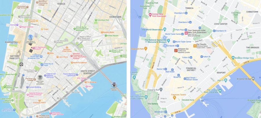
This photo better demonstrates some of the many differences between the two applications. In Apple Maps, each building’s outline is shown in detail, with some even shown in an “immersive 3D” mode, where influential structures including the New York Stock Exchange, One World Trade Center, and Brooklyn Bridge are specially modeled to reflect their appearance in real life. While this is not featured in Google Maps, Google Maps has greater detail in parks’ paths, ferry lines, transit routes and stations in this zoom level — in fact, even businesses have their logo displayed above their location.
3D Satellite View

In this photo and overall, Apple Maps has a more realistic view of individual buildings with their shadows displayed while Google Maps has practically no shadows. Although prominent shadows do create a sense of immersion, it could be difficult to see streets that are blocked by trees or buildings. However, unlike Google Maps, Apple Maps does display road names on this view.
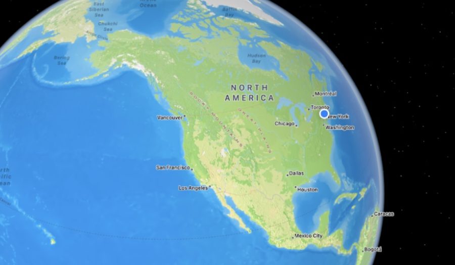
Globe View
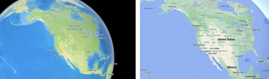
Apple Maps is the clear winner in this case; the details on the bodies of water, mountain ranges, islands, deserts, and forests are unparalleled. The background is also speckled with stars, giving the impression that Earth is in fact a planet rather than a sphere surrounded by a static blue background. It is notable, though, that states and countries in this zoom distance are clearly outlined in Google Maps and not in Apple Maps.
Verdict
Both applications have their own distinct pros and cons, but when used together they create a truly incredible experience that was not possible just a few years ago. If they had to be used separately, Apple Maps would be best for immersion and graphics while Google Maps would be best for navigating somewhere new.